Island Maps
Click on an image to see the island with outlines of the district divisions and state routes.
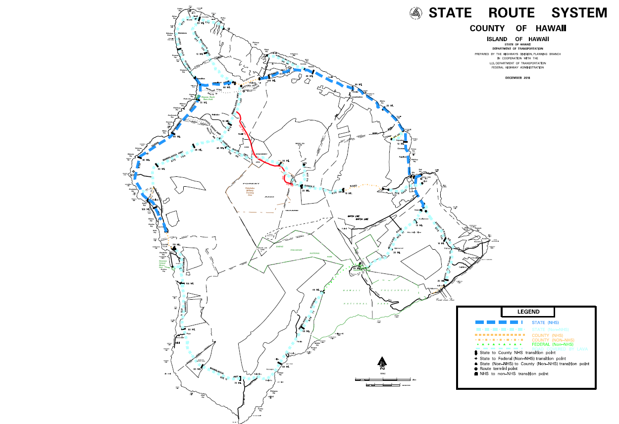
State Routes on the Island of Hawaii
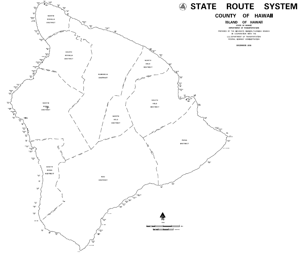
Districts on the Island of Hawaii
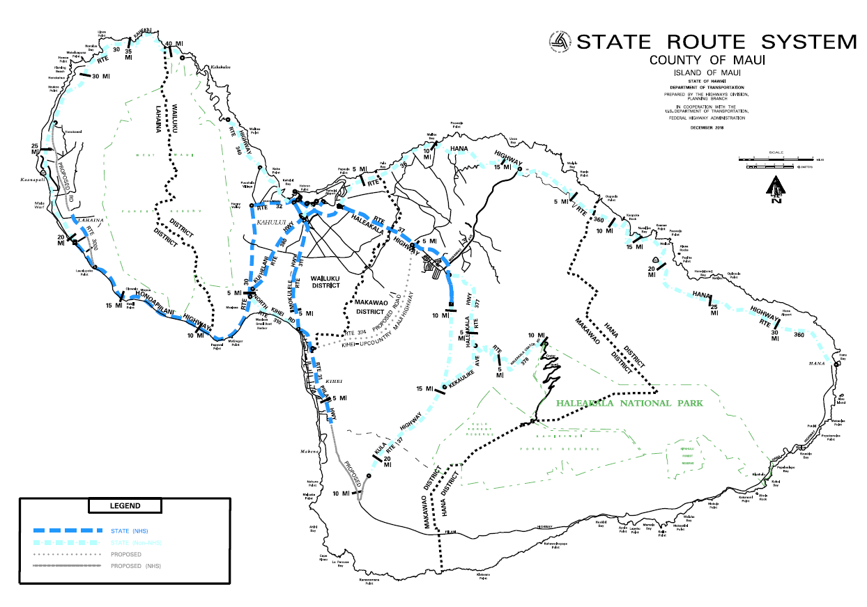
Maui District Map
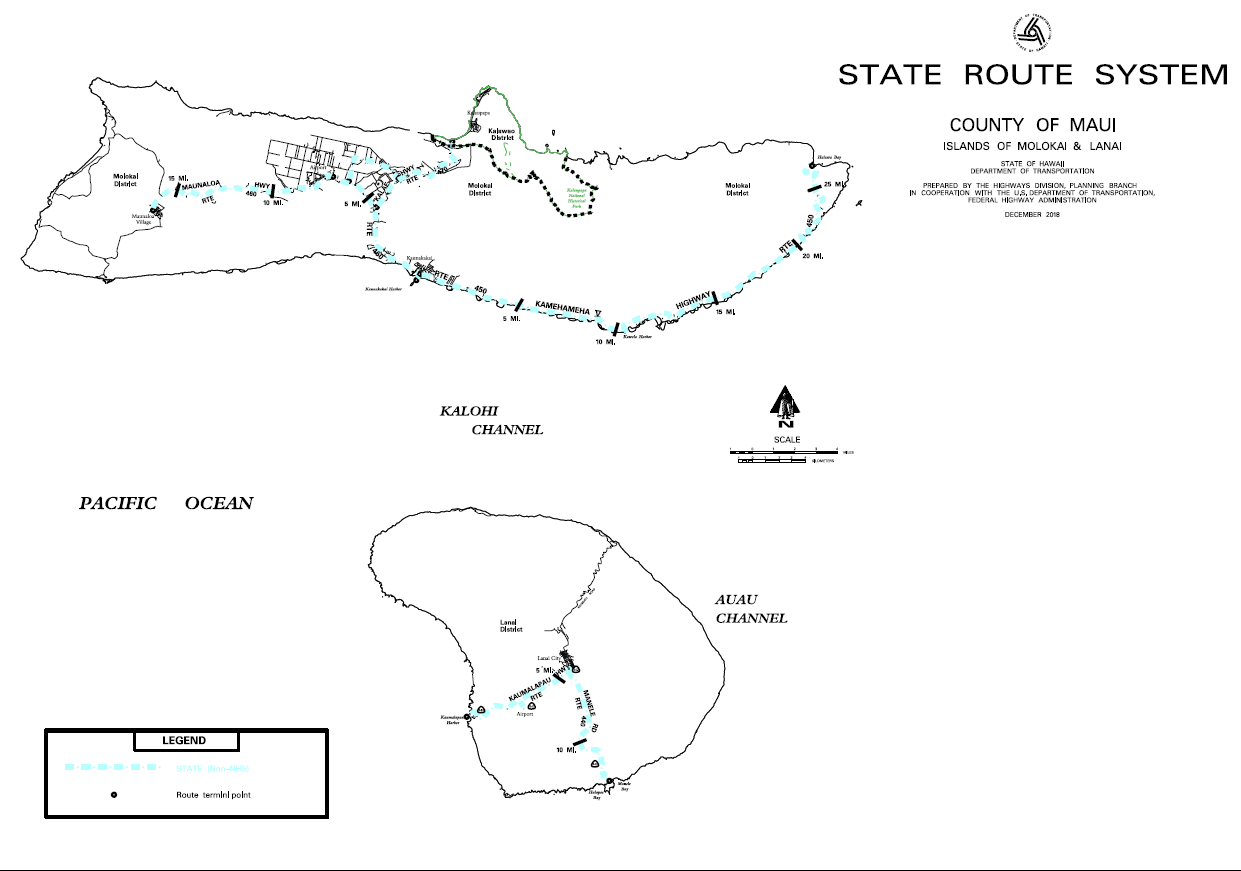
Molokai and Lanai Maps
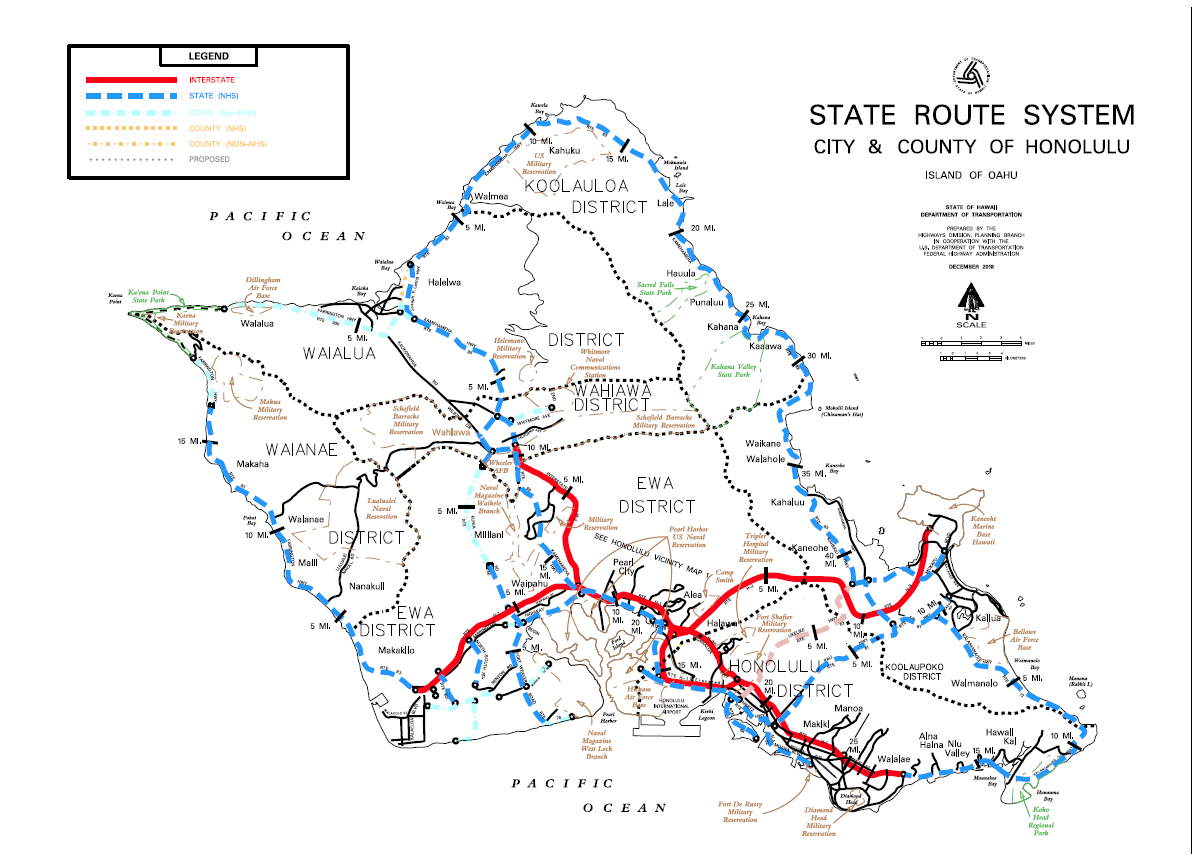
Oahu District Map
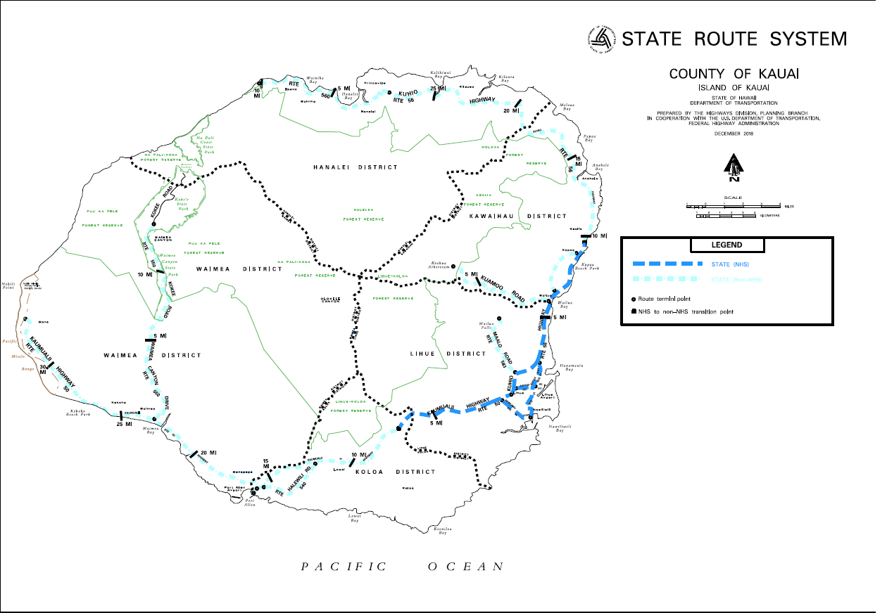
Kauai District Map